Chrysotile Location
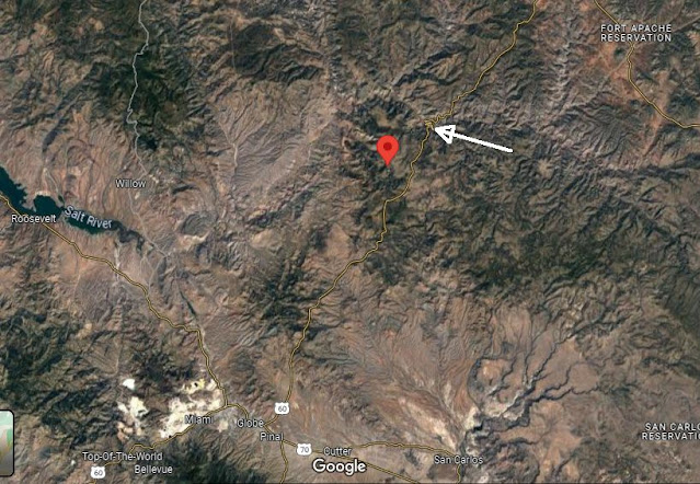
Very few folks know precisely where Chrysotile, Arizona, is located. This post attempts to provide perspectives about the small community's location. Comments are below each graphic.
Here is a general vicinity clip from Google Maps. The red push pin is Chrysotile. The tip of the white arrow is US 60 through Salt River Canyon. Globe is visible toward bottom left.
This topo map clip shows Chrysotile (red pin "A") in relationship to US 60 through Salt River Canyon.Here's a zoom of the above topo clip. Chrysotile is 3-4 miles west of US 60 in Ash Creek Canyon.US 60 is now located fairly close to Chrysotile. However, for the first approx. 20 years of the community's existence, the route to Chrysotile was long and rough.
The red lines show generalized road locations.
Here's a Google Earth view of Ash Creek Canyon looking "downcreek".
This is a broader Google Earth perspective of Ash Creek Canyon looking toward the Salt River Canyon far beyond. The white areas are asbestos mine tailings piles.


Comments
Post a Comment