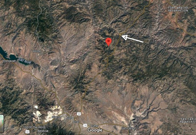
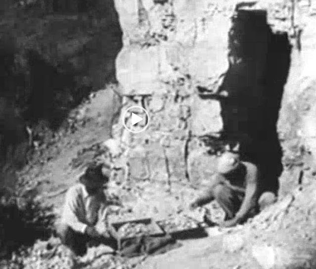
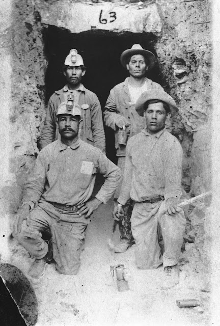
Posts

Chrysotile Asbestos

Image
  An ancient, intercontinental slip and slide set the stage for Gila County's abundant chrysotile asbestos deposits.  By the time the amalgamation of the Rodinia Supercontinent got it's gig a goin' on, pieces of modern-day Africa and So. America were attached to the eastern seaboard!  Now we're talkin' EARLY in Earth's history!  The diabase intrusions that eventually became ginormous sills in the billion-year-old Apache Group rocks started out as as paper-thin pulses that radiated their entire length slowly, then swelled and fattened in place. And while all that diabase swelling and fattening was taking place, it just so happened to be slow cooking the heck out of the adjacent Mescal Limestone.  VOILA!  Asbestos was born! While the wildly rich Porphyry copper deposits get all the headlines, the persistent diabase sills created yet another profitable mining industry in Gila County.  Asbestos set prospectors hearts aflutter beginning about the time Arizona morphed

Chrysotile Location

Image
 Very few folks know precisely where Chrysotile, Arizona, is located. This post attempts to provide perspectives about the small community's location. Comments are below each graphic. Here is a general vicinity clip from Google Maps.  The red push pin is Chrysotile.  The tip of the white arrow is US 60 through Salt River Canyon.  Globe is visible toward bottom left. This topo map clip shows Chrysotile (red pin "A") in relationship to US 60 through Salt River Canyon. Here's a zoom of the above topo clip.  Chrysotile is 3-4 miles west of US 60 in Ash Creek Canyon. The 1922 map clip above is from the earliest map showing Chrysotile that we could find. US 60 is now located fairly close to Chrysotile.  However, for the first approx. 20 years of the community's existence, the route to Chrysotile was long and rough.   The red lines show generalized road locations. Here's a Google Earth view of Ash Creek Canyon looking "downcreek". This is a broader Google E

Asbestos technical reports

Image
There are many technical reports regarding Gila County asbestos deposits and mining operations. It's totally out of the scope of this blog to attempt to list and excerpt each of the available reports.  This particular report, however, should be #1 on your list to download and digest.  It was published in the mid-1950's by the US Bureau of Mines.  Consequently, the information contained in the report was probably collected beginning in the late 1940's through the early 50's.  The report represents a snapshot of Gila County asbestos near the peak of its "popularity".  Below are a few excerpts from the report. The report is located here:  https://digital.library.unt.edu/ark:/67531/metadc67066/ Arizona asbestos mines are the only sources on the American continents of naturally iron-free chrysotile spinning fiber that is so urgently needed for electric-cable coverings, especially on warships. Asbestos was first recorded and recognized in Arizona in 1872, and a mino

Globe Miami Times Chrysotile Article

Image
  The "Globe Miami Times" ran a great article about Chrysotile, Arizona, by Linda Gross in January 2018.  The article features a fine photo by Virgil Alexander.  Here is the link to the article https://www.globemiamitimes.com/chrysotile-arizona-first-hand-accounts-life-asbestos-mine/

1921 Chrysotile Film

Image
The US Bureau of Mines produced a 90 minutes film in the early 1920 entitled "The Story of Asbestos."  It focused on the Johns-Manville mines and subsequent processing facilities.  Luckily, the film contains 11 minutes and 40 seconds of Chrysotile-related footage.  Ricardo Rico graciously processed the 3.2 gig file to extract the 11:40 clip of Chrysotile.  You can click on the player or, better yet, use the Vimeo link for a much higher quality rendition.  A dozen screen clips from the film are included below.  https://vimeo.com/870293403 Most of the work sorting high grade asbestos ore was done by hand.  It was called "cobbing". While most all major mines elsewhere in America were using the latest and greatest technology, chrysotile mining still utilized burros to carry ore between the mine and the local processing mill. Each burro generally carried two 100 pound bags of ore. Herding burros was part of the daily mine activities. The film includes some footage of the

Faegol to Chrysotile

Image
A Leveler of Hills (Editor's Note: The narrative below is a verbatim transcription of a 1919 article.  Some of the grammar is awkward. The article is reproduced here to give an idea of the difficulty in traveling to and from Chrysotile.) "Driving a Fageol truck, Frank Free and Curt E. Henderson, accomplished what in the opinion of the Johns-Mansville asbestos mine officials at Chrysotile was the impossible because of the fact that every other make of truck attempting the grind from Rice to the mine over mountainous roads which in places registered as much as 20 per cent, had failed completely. "It can't be done," said the mine officials, but the fact that the truck was turned, sent the old proverbial 'can't' to the mat once more for a complete knockout. It was because of this defy that the Ferguson-Keeler representatives tempted to make the run in a 22-ton Fageol, loaded to more than its capacity with supplies and prove the mettle of their steel brute

Chrysotile Miners

Image
 Mexican men worked the Chrysotile Mines. This is a photograph outside of the opening to a mine in Chrystotile, Arizona taken on May 2, 1921. The individuals identified in this image are of Reyes G. Moroyoqui (top right) and Ramon G. Moroyoqui (bottom right). Source:  https://azmemory.azlibrary.gov/nodes/view/ According to Gene Knuckey's book, "Mexicans constituted about 95% of the employees at locations, Sonora (shown below) was the largest residential section of Chrysotile (Photo courtesy Gene Knuckey's book "Chrysotile, Arizona, 1914-1945.)

Salt River Near Chrysotile

Image
Perhaps the last remaining public vestige of Old Chrysotile is the Salt River USGS/SRP stream gage* located near the US 60 bridge at the bottom of Salt River Canyon.  It has always been customary tradition for the USGS to name a stream gage as "near" the nearest community.  Sometimes the nearest community would be many miles away but that didn't matter.  When this gage was first installed in 1924, Chrysotile, Arizona, was a "happening" place and so it made sense to name the gage "Salt River Near Chrysotile". Untold thousands of river runners and water users watch spring runoff and monsoon flow data from this gage.  It's probably safe to speculate very few of those watching this gage have any idea why it is named "near Chrysotile".  As Old Chrysotile fades farther into the dust bin of history, at least there is one tangible structure that still bears the community's name. Just in case you're curious, the straight line distance betw